 SpotFlight — home page
SpotFlight — home page
SpotFlight — home page
Loading aircraft…
On the ground
See them in your sky — SpotFlight for iPhone
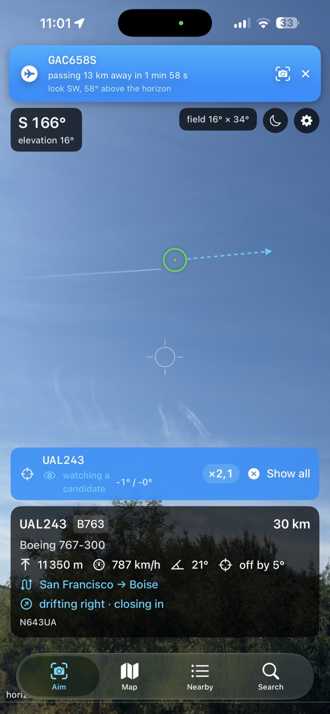
Hold your iPhone up to the sky: every aircraft in front of you gets a circle where it really is, and the ones you aim at get a label — callsign, altitude, distance. Free to download.


Scan with your iPhone’s camera. For iPhone, iOS 17 or later.
No recent position: this aircraft is no longer being received.
Airline: OpenFlights, ODbLAirline and route: adsbdb.comRoute: adsbdb.com
| Flight | Type | Altitude | Speed |
|---|
This page draws the aircraft flying right now on a 3D globe, coloured by altitude. It needs JavaScript and WebGL 2, which this browser does not provide — recent versions of Safari, Chrome, Firefox and Edge do, and so does every iPhone since iOS 15.
SpotFlight does the same thing where it counts: hold your iPhone up, and the aircraft above you are labelled in their real place on the camera image.
Aircraft positions come from adsb.lol, a flight-tracking network fed by volunteers. SpotFlight’s relay converts adsb.lol’s data from its binary format and keeps, for each aircraft with a known position, its address, callsign, type, registration, category, position, altitudes, ground speed, track, vertical rate, squawk and position age, rounded (position to 0.0001°, altitudes to 25 ft, speed to 1 kt, track to 1°, position age to 0.1 s). The aircraft data served to this page is available under the Open Database License 1.0.
Your browser extrapolates each position from its last report, along its track; the age of the data is shown on the map. An aircraft whose last position is more than two minutes old fades out and disappears.
Coverage depends on volunteer receivers: dense over Europe and North America, thin over oceans, and many military and private aircraft are absent.
Colour shows barometric altitude: indigo near the ground, cyan at 10,000 ft, white above 30,000 ft. When the view is tilted below zoom level 9, heights are exaggerated so that altitude can be seen at all; the legend gives the factor.
The airline is read from the callsign: its first three letters name the operator, so AFR1234 is Air France. Its name is looked up in your browser, in a list served by spotflight.eu and the same for everyone, drawn from a 2017 snapshot and limited to active airlines with an ICAO code — some recent airlines are missing, and some names are out of date. An aircraft flying under its registration, as most private aircraft do, has none. Contains information from OpenFlights Airlines Database, which is made available here under the Open Database License (ODbL). The list itself, compagnies.json, is available under the same licence.
Departure and arrival cities are asked for one flight at a time, when you open an aircraft’s card: its callsign, and nothing else, goes to spotflight.eu, which asks adsbdb.com on its own behalf — never with your address. When adsbdb.com knows the airline, its more recent name is the one shown. Flight route information is provided by adsbdb.com. The flight route data is the work of David Taylor, Edinburgh and Jim Mason, Glasgow, and may not be copied, published, or incorporated into other databases without the explicit permission of David J Taylor, Edinburgh.
The globe starts over your time zone, read by your browser: the time zone itself is never sent, and the map of the region it points to is then loaded from spotflight.eu, like any other view. Places, airlines and flights are searched in your browser too: what you type never leaves it. Everything on this page comes from spotflight.eu — no third-party scripts, fonts or maps, no cookies, no analytics. Your choice of units is remembered in your browser only.
Map data © OpenStreetMap contributors, available under the Open Database License; basemap by Protomaps. Place names from Natural Earth. For enjoyment, never for navigation.