


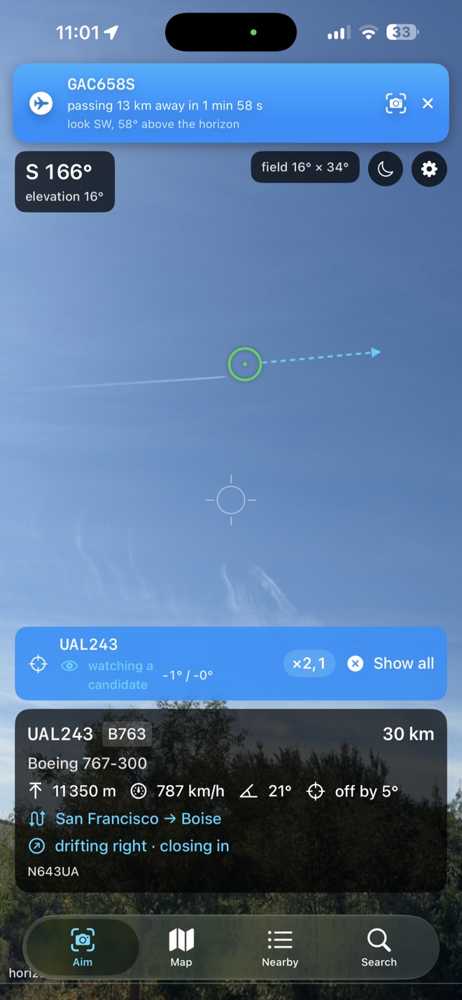
Hold it up. Read the sky.
Every aircraft in front of you gets a circle where it really is, and the closest ones get a label: callsign, type, altitude, distance, route, and which way it is drifting across your view.
Tap one to follow it alone and pinch to zoom in. Drag anywhere to correct the compass — the labels follow your finger onto the aircraft you can actually see.
30 km · 11 350 m · 787 km/h19 mi · 37,200 ft · 489 mph · off by 3°
San Francisco → Boise · drifting right
Metric, imperial, or the cockpit's own — that last one reads FL372 and 425 kt.
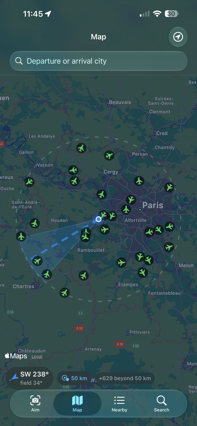
See what you would catch.
Traffic on its real heading, and the cone is the camera's actual field of view — not a decoration. Point that way, and that is what lands on your screen.
Range 50, 100 or 200 km,Range 31, 62 or 124 mi, because near an airport a hundred labels are worse than twenty.
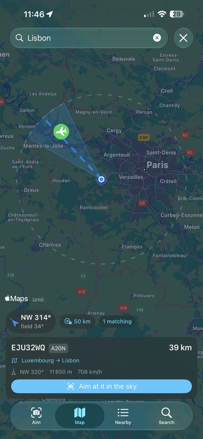
Where is that one going?
Type a city the way you say it. Londres finds London, Alger finds Algiers — the flight database is in English, so the app carries the exonyms.
Find the flight on the map, then send it straight to the sky.
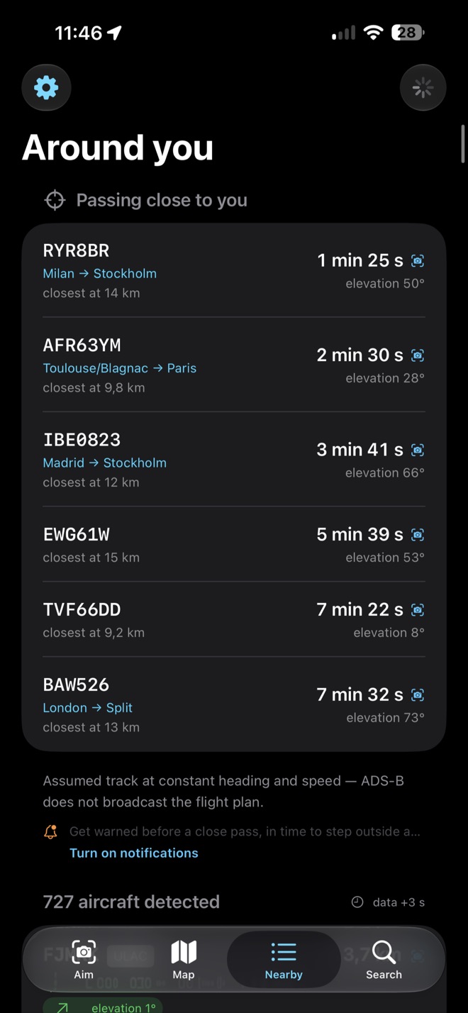
A minute's warning.
What is about to pass over you, how long you have, how close it will come and how high to look. Long enough to put your shoes on.
Passes that happen below the horizon never fire. An airliner landing forty kilometres away is not worth looking up for, and the app knows it.
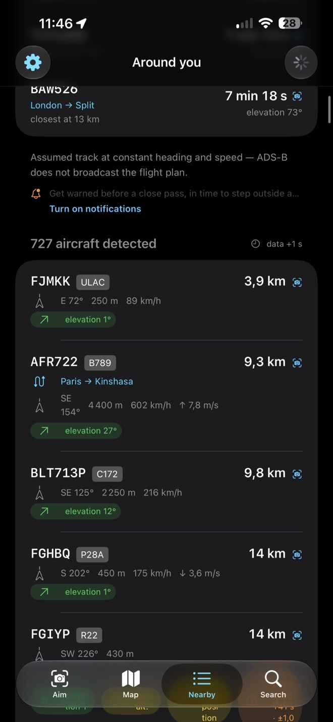
Everything in range, nearest first.
Bearing, elevation, altitude, speed, climb rate. Tap any row to go and aim at it.
And badges that say what the app does not know: a position that had to be extrapolated, an altitude that is barometric rather than geometric, a target hidden below the curve of the Earth.
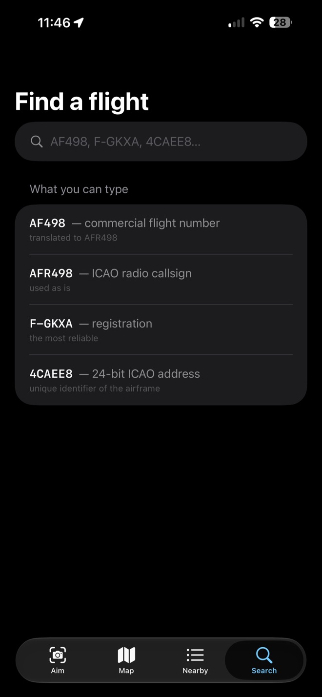
Four ways in.
The number on your boarding pass, the radio callsign, the registration painted on the tail, or the 24-bit address the transponder broadcasts.
They are not the same thing, and the app says so: some airlines fly under callsigns that have nothing to do with your ticket, and it warns you rather than letting you think it is broken.
F-GKXA · registration — the most reliable
An airliner crosses the Sun in about one second.
From exactly where you are standing, SpotFlight works out the moment an aircraft will cross the disc of the Sun or the Moon, up to five minutes ahead, with where to look and how long it lasts. Nobody catches that without being told it is coming.
The astronomy is checked, not approximated — and the Moon is computed for your own position rather than the centre of the Earth, a difference of nearly a degree, twice its own width.
Free, and honest about the rest.
- Free to download. No subscription, no in-app purchase, no account, no analytics from me, no tracking.
- Your first 24 hours are fully open — nothing is asked of you while you find out whether you like it.
- After that, the camera view and transit prediction are unlocked for another 24 hours by a rewarded video you start yourself. No ad is ever shown on its own.
- The map, the list, the search and the passage alerts are always free.
- Your coordinates go to the public aircraft feed because that is the question being asked. Nothing is stored — no address, no position, no history. The privacy policy says exactly what the ad software does, including the part I cannot switch off.
The compass is the limit, not the maths.
Every phone's compass is off by 5 to 15 degrees depending on what is around it — a magnetic case is enough. Every other source of error is orders of magnitude smaller. That is why you can drag to correct it, and why the app shows you the figure it is working with.
Coverage comes from volunteer receivers: strong over Europe and North America, thin over oceans and open country. Military and many private aircraft broadcast nothing usable. For enjoyment, never for navigation.